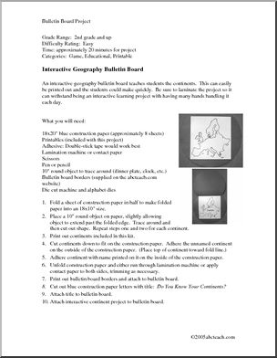
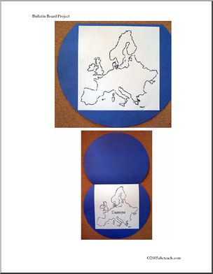
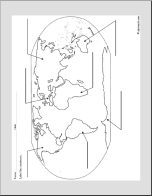
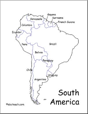
Maps worksheets for students are a fantastic way to enhance their geographical knowledge and map-reading skills. These worksheets often include activities such as identifying continents, countries, and cities on maps, interpreting topographic maps, and understanding map symbols. They can also delve into the fascinating world of cartography, teaching students about map projections, scales, and legends. Maps worksheets not only help students become proficient in navigation but also foster an appreciation for the diversity of our planet.

299 Results
Maps
Map Skills: Nunavut, Canada (with map)
PREMIUM

Maps / Canada

Media Type PDF

Map Skills: Ontario, Canada (with map)
PREMIUM

Maps / Canada

Media Type PDF

Map Skills: Prince Edward Island, Canada (with map)
PREMIUM
Map Skills: Yukon, Canada (with map)
PREMIUM

Maps / Canada

Media Type PDF

Map Skills: Nova Scotia, Canada (with map)
PREMIUM
Map Skills: Alberta, Canada (with map)
PREMIUM

Maps / Canada

Media Type PDF

Map Skills: British Columbia, Canada (with map)
PREMIUM